


Fugro contracted for flood risk data services to FEMA, USA
 Fugro, as a member of the Compass PTS joint venture, has been awarded a contract for flood risk data services to Federal Emergency Management Agency (FEMA) that has the national responsibility for flood zoning and insurance.
Compass PTS joint venture is led by AECOM Technology Corporation and CDM Smith, and unites partners Fugro, T&M Associates, Halff Associates, and ABSG Consulting.
The joint venture will provide architectural and engineering support services to continue FEMA’s goals to reduce risk to life and property by increasing public awareness.
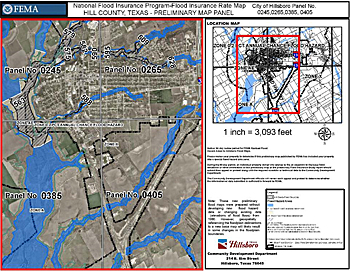 Fugro's Lidar flood plain maps are used by FEMA to produce flood insurance rate maps, such as this one for Hill County, Texas.
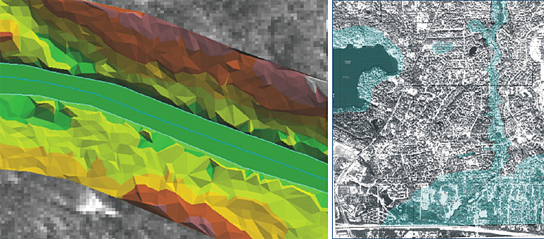
Lidar flood plain mapping
As the geospatial content and knowledge provider of the joint venture, Fugro will deliver integrated Lidar-derived solutions and traditional and oblique imagery solutions as well as visualization software.
The geospatial knowledge will aid in critical flood management services to support FEMA’s Risk Mapping, Assessment and Planning (Risk MAP), Hazard Mitigation Technical Assistance Program (HMTAP) and Technical Assistance and Research Contracts (TARC) programs.
Nationwide flood preparedness
"Fugro is proud to work with its Compass joint venture partners to support FEMA’s critical mission activities", said Fugro Geospatial President, Brian Wegner. "We recognize the significance of improving nationwide disaster preparedness and recovery and appreciate the opportunity to contribute to this important goal."
 More about Lidar mapping
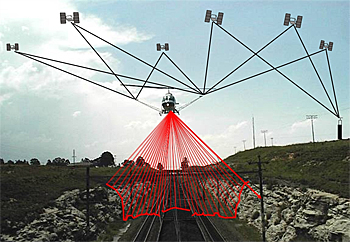
Fugro operates multiple airborne Lidar sensors (LIght Detection And Ranging of Laser Imaging Detection And Ranging) to provide fast and accurate elevation data.
Applications for Fugro's Lidar mapping services include floodplain mapping, forest inventory, transportation and utility corridor mapping, land-use/land-cover classification, 3D urban modeling, and line-of-sight analysis, among others.
Fugro constantly improves its sensors, processing software, and production techniques, making it a Lidar mapping leader.
This news item was originally published on the website of Fugro.
More information
Fugro EarthData, Inc
Frederick, USA
+1 301 948 550
www.fugroearthdata.com
Fugro
Leidschendam, the Netherlands
+31 70 311 1422
www.fugro.com