


Nelen Schuurmans brings geodata service to Engro Fertilizers, Pakistan
 Nelen & Schuurmans will provide geospatial information services to Engro Fertilizers, improving food production and crop monitoring of thousands of rice and wheat acres in Pakistan.
The data service will provide Engro Fertilizers with near real-time data that farmers can use to improve the efficient use of water, fertilisers and pesticides.
Within the first year an information chain for monitoring crop conditions and yields will be set up.
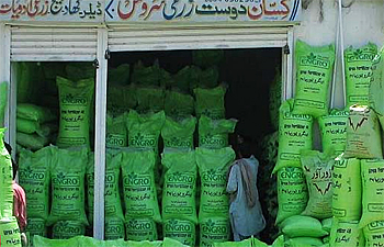 Pakistan producer of fertilizer, Engro wants to provide geo-based data services to farmers with real-time data on efficient use of water, fertilisers and pesticides. (photo: Engro)
Spin-off
The service is a spin-off from the G4AW Sat4Rice information services that was firstly developed for rice farmers in Vietnam and shall be adapted to the terrain of Pakistani farmland during a one-year development project.
Engro Fertilizer is one of the largest fertilizer manufacturers of the world. Driven by a vision to improve productivity and lifestyle for thousands of farmers across Pakistan, Engro aims to use this innovative information technology to bring this vision to the next level.
Value chain
Engro Fertilizers Head of Agribusiness Solutions Division, Mohsin Ali Mangi states, ‘Various stakeholders in the Agri-value chain could benefit by receiving prompt bird-eye views of crop quality over large geographic zones.
Mangi continues: "Engro’s eventual goal in undertaking this project is to help the farmer, the market buyer and the crop advisors in timely decision making and in the coming years lead Pakistan into cutting-edge crop monitoring practices."
Field data
The first step in the partnership is to focus on providing new geospatial information to the work of Engro using digitally collected field data and state-of-the-art satellite imagery. For these images Nelen & Schuurmans is supported by Sarvision, one of their preferred data partners and specialised in interpretation of radar satellite signals.
Director Fons Nelen of Nelen & Schuurmans says, "Our Lizard platform technology makes valuable insights into crop performance accessible for multiple actors across Engro’s agricultural value chains."
Nelen anticipates the Lizard platform to generate new information by integrating and analysing large amounts of data from a wide range of sources, including satellites, IoT devices and smartphones.
About G4AW
Geodata for Agriculture and Water (G4AW) is a programme commissioned by the Dutch Ministry of Foreign Affairs to improve food security in developing countries by using satellite data.
Netherlands Space Office (NSO) is executing this programme. Geodata-based crop advisory tools that have been developed include Angkor SALAD for sustainable vegetable farming in Cambodia, MYVAS4AGRI mobile services for agriculture in Myanmar, Sat4Farming for cocoa farmers in Ghana and Sat4Rice for rice farmers in Vietnam.
This news item was originally published on the website of Nelen & Schuurmans.
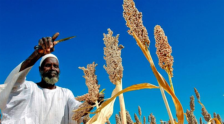
(top photo: G4AW)
Read also on this website:
● VanderSat and Kisters launch global cloud-based service for soil moisture and drought data, 26 February 2019
● Stockholm World Water Week 2018: Latest generation water-related apps for small farmers shown at African Spatial Delight, 4 September 2018
● Wageningen University and Rabobank help smallholder farmers worldwide to secure crop yields, 5 February 2018
● Expertise: Water and agrifood
More information
Nelen & Schuurmans
Uttrecht, the Netherlands
+31 30 233 02 00
www.nelen-schuurmans.nl/en
Geodata for Agriculture and Water (G4AW)
The Hague, the Netherlands
+31 88 042 4500
www.g4aw.spaceoffice.nl