


Deltares and Unesco-IHE sign MoU to help Mauritius on further disaster risk reduction
 On 20 January, research institute Deltares welcomed the Honourable Jayeshwur Raj Dayal, the Minister of environment, sustainable development, disaster and beach management of Mauritius.
Minister Dayal signed an Memorandum of Understanding with Deltares and water education facility Unesco-IHE about further cooperation in the future relating to climate adaptation and disaster risk reduction in Mauritius.
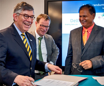 Signing of the MoU, from left to right: Fritz Holzwarth, (Unesco-IHE interim rector), Maarten Smits (Deltares managing director) and Jayeshwur Raj Dayal (Mauritius minister).
Training and capacity building
The MoU continues the cooperation on climate adaptation in the areas:
- consultations and exchange of expertise in the fields of research and training;
- provision of services and support to update/extend the warning system and ensure its operation and
- training and capacity building in the field of disaster risk reduction management, coastal engineering and adaptation to climate change.
Early warning system in place
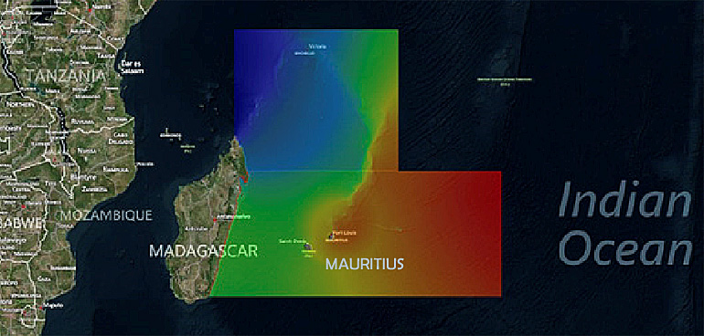
This MoU emerged after the successful completion of a project to build an early warning system (EWS) for Mauritius.
The system was delivered in the summer of 2015 by Deltares, providing Mauritius, as the first Small Island Developing State (SIDS)’ in the Indian Ocean, with its own flood warning system so that the country will be better prepared for extreme high water as a result of, for example, cyclones. (on top illustration, in red is sea level increase of 0.75 m).
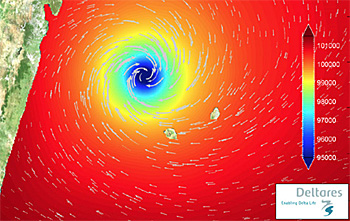 Presentation in EWS of the large cyclone Gamede that hit Mauritius in 2007.
Prediction of water levels and threshold crossings
The early warning system for Mauritius is based on Deltares' Delft-FEWS open data handling platform.
This platform was initially developed as a hydrological forecasting and warning system that has been extended to cover tide, storm surge and wave forecast.
Now FEWS is a sophisticated collection of modules designed for building a forecasting system, customised to the specific requirements for inland and coastal areas of an individual organisation.
The end-product of the Mauritius early warning system (EWS) is a set of intuitive tables in HTML format for each island, containing time- and space-varying information on threshold crossings by predicted water levels.
At multiple locations for each island, the operator is informed in one glance about the recommended warning level, from 'safe' to 'watch', 'alert' or 'warning' based on water level forecasts.
This news item was originally published on the websites of Deltares and Unesco-IHE.
Read also on this website
● AfriAlliance to strengthen link between Africa and Europe on water and climate, 13 January 2016
● Deltares presents composition of flood maps using satellite data through Google Earth Engine, 17 December 2015
● Deltares to share experiences on modelling with new Colombian hydrological centre of IDEAM, 7 September 2015
● AGU Fall Meeting 2014: High performance 3Di hydraulic software visualizes route of legendary Alcatraz escape, 14 December 2014
● Unesco-IHE signs MoU with Hong Kong Drainage Services on storm water management, 24 November 2014
More information
Deltares
Delft, The Netherlands
+31 88 335 8273
www.deltares.nl/en
Unesco-IHE
Delft, the Netherlands
+31 15 212 29 21
www.unesco-ihe.org