


FutureWater and HiView report successful aerial land-water observations using UAVs in the Himalayas, Nepal
 Since December 2012 research and consulting organisation Future Water and flying sensor specialist HiView work together on three projects collecting data for land- and water management by using unmanned aerial vehicles (UAV).
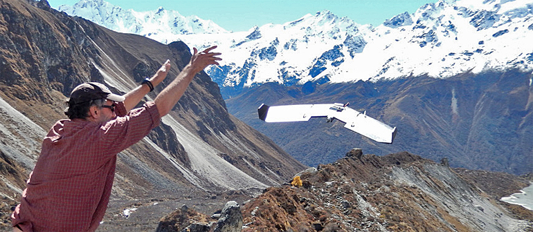
One of the projects is for the International Centre for Integrated Mountain Development (ICIMOD). Future Water and HiView assist the centre with UAVs in a cryospheric monitoring in two glacierised catchments in Nepal.
The 'flying sensors' have been used to monitor the extent of the glacier lakes, the mass balance of debris covered tongues and surface velocities.
 More details on the glacier surface
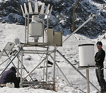
Climate change has a strong impact on glaciers and as a result glaciers are globally receding, thinning and their flow velocities are decreasing. Field work on glaciers is challenging and expensive and current field methods are still notably uncertain.
Satellite remote sensing is commonly used for monitoring glacier changes, but the resolution of most satellite based sensors is to coarse to investigate detailed processes occurring on the glacier surface.
Using the UAVs of HiView, in combination with advanced image processing software, detailed maps of the surface elevation, melt and flow velocity and glacier extent can be generated.
By using imagery from different dates important information on melt, flow and extent of glaciers can now be quantified at an unprecedented resolution.
 Third generation remote sensing
Flying Sensors on UAVs can be considered as the third generation remote sensing. First generation remote sensing was done from manned airplanes, which is very costly and requires substantial preparation time and access to airfields. Second generation remote sensing is the use of satellites. Notwithstanding the tremendous opportunities satellites offers, the practical application is hampered by clouds, low resolution, and inflexibility in overpass time.
Flying Sensors can overcome those problems by delivering information at the requested time, at the specific location, at a very affordable price, and at an ultra-high resolution.
Three successful projects
After one year of piloting Future Water and HiView already completed three commercial projects successfully while simultaneously development, testing and improvement continued.
Based on this success the companies decided to continue to provide this service and ensure the use of Flying Sensors in support of a wide-range of clients from scientists to nature conservancies to farmers.
This news item was originally published on the websites of Future Water and HiView.
More information
Future Water
Wageningen, the Netherlands
+31 317 46 00 50
www.futurewater.nl
HiView
Arnhem, the Netherlands
+31 6 1814 1772
www.hiview.nl