


University of Twente supports agri network with collection of geodata in three Ethiopian watersheds
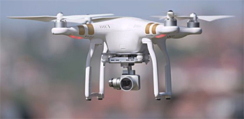
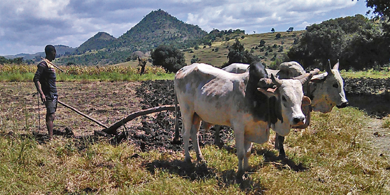 University of Twente started, together with three Ethiopian universities, the four-year Ethiopian Education Network to Support Agricultural Transformation (EENSAT) programme to enhance the collection and use of geodata for agriculture and regional development. Part of EENSAT is to operate drones for the 3d high resolution mapping of three watersheds. The first drone flights have been conducted recently.
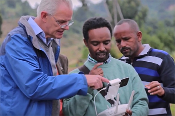 Ben Maathuis (left) of Twente University and Birhanu Gedif of Bahir Dar uinversity controlling the drone on one of its first flights.
Optimise spatial data
The programme has been set up to help Ethiopia to optimally capitalize on geoinformation and geoinformation technology for food security, water management, and climate change.
These issues are closely related and extremely complex. The use of spatial data can make an important contribution to the resolution of these issues.
Part of the programme will pay attention to other issues such as spatial issues with regard to land ownership and risk management in the field of disaster relief.
Supporting equipment
Instrumentation will be installed such as automated weather stations, as well as other supporting equipment to quantitatively analyse the water and energy balances, as well as equipment to analyse plant spectral response.
This installation will be supported by low cost ground reception stations to acquire near real time satellite based observations and derived products relevant for atmosphere, land, water and climate research applications.
 New studies
Teaching and research initiatives have been set up to boost cooperation between the public and private sectors.
Quantitative and qualitative applied MSc and PhD studies will be conducted in the fields of agriculture, natural resources, surveying, geo-information technology, natural sciences and computational sciences which all have relevance to the demands of the labour market.
In October the Faculty of Geo-Information Science and Earth Observation (ITC) of the University of Twente signed an agreement on the EENSAT programme with the Ethiopian Minister of Education and the Universities of Bahir Dar, Addis Ababa, and Mekelle.
This four-year programme is primarily being funded by the Dutch Nuffic's Innovative Capacity Building programme, with an additional contribution from the Ethiopian Ministry of Education and ITC.
This news item was originally published on the website of the University of Twente.
Read also on this website
● ITC Water Resources leads study into the use of satellite data to optimize water level control, 25 February 2015
● Expertise: Water and agrifood
● Country: Ethiopia
More information
University of Twente
Department Water resources
Faculty of Geo-Information Science and Earth Observation (ITC)
Enschede, the Netherlands
+31 53 487 4444
www.itc.nl/wrs
and
EENSAT programme
www.eensat.org
Project manager Ben Maathuis of the University of Twente highlights the use of drones to compose high resolution 3D-images as part of the EENSAT programme.