


Fugro contracted for detailed survey Pacific island country of Tuvalu
 Geo services firm Fugro has been awarded a contract by the United Nations Development Programme (UNDP) to survey the Polynesian island country of Tuvalu.
The data will primarily support the Tuvalu Coastal Adaptation Project’s island vulnerability assessment work.
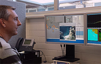
The survey, to be conducted in 2019, will utilise Fugro’s airborne lidar bathymetry (ALB) technology, providing accurate national coverage of shallow (0 - 50 metres), nearshore and lagoon bathymetry and island topography.
 Furgo's airborne lidar bathymetry (ALB) technology provides accurate base line data for vulnerability assessment.
Vulnerable to climate change
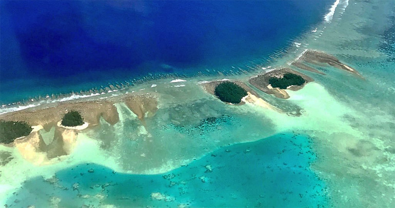
Located in the Pacific Ocean, Tuvalu is the world’s fourth smallest nation with a population of around 11,000 and a total land area of 26 square kilometres.
The country is remote and, with low lying islands, is one of the most vulnerable to the effects of climate change.
The survey data will also feed into a very broad spectrum of vulnerability, adaptation, infrastructure development, natural resource management and environmental monitoring needs.
Advanced mapping technology
Fugro director Paul Seaton, for Business Development and Government Relations for Asia Pacific, commented: ‘Tuvalu’s remoteness and susceptibility to the effects of sea level rise and tropical storms will benefit from Fugro’s advanced technology for mapping shallow water environments safely and cost-effectively.’
‘Our surveys will provide the baseline data necessary to plan adaptation and resilience responses’, Seaton said.
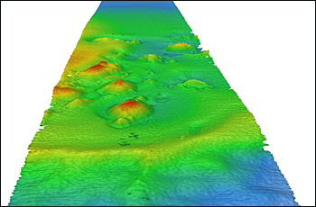
A typical bathymetryi mage showing the different elevations.
Improved baseline data
The provision of this data is seen as a big step towards improved planning, understanding resources and assessing national vulnerability.
Important services, such as navigation in shallow waters, will also be greatly enhanced and the baseline data will be of key interest to development partners and local authorities.
For the first time since rising sea levels have been a concern in Tuvalu, detailed and accurate information regarding the relationship between land height and sea level across all nine coral islands will be available.
This news item was originally published on the website of Fugro.
(Photos: UNDP and Fugro)
Read also on this website
● Fugro to provide ground intelligence for high speed railway works, UK, 26 July 2018
● Fugro supports Seabed 2030 initiative to map entire world’s ocean floor, 28 February 2018
● Expertise: Enabling delta life
More information
Fugro
Leidschendam, the Netherlands
+31 70 311 1422
www.fugro.com