Deltares presents GLOFRIS flood forecasting model to risk experts at World Bank forum, London, UK
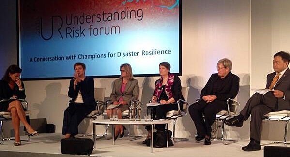
During the technical session on flood risk assessment at a forum meeting by the World Bank in London on 1 July, Hessel Winsemius brought up the Global Flood Risk with IMAGE Scenarios (GLOFRIS) as recently developed by research institute Deltares.
Winsemius is an expert on global flood risk working with Deltares and he was involved in the development of the GLOFRIS model to enable a quick assessment of current and future global river flood risks.
The model is described in one of case studies in the World Bank report Understanding Risk that was officially launched at the forum.
 Hessel Winsemius, Deltares
Combining latest generation models
Many developing countries have no adequate tools for an efficient flood risk management. With the increasing availability of large scale datasets, and new generations of weather and flood forecasting models, tools for assessing floods risk at the large scale are currently being developed.
Deltares developed GLOFRIS to assess changes in flood risk at the global scale under a wide range of climate and socioeconomic scenarios.
In this way, scientists, governments and industry can determine whether flood risk may increase or reduce as a result of naturally occurring variations in the climate system as well as consistent changes.
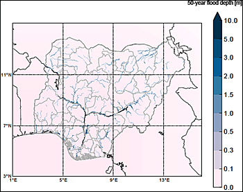 GLOFRIS map of Nigeria predicting the inundation extend in case of a 50-year flood event.
Quick but not so dirty
The World Bank included GLOFRIS in its report Understanding Risk, The evolution of Disaster Risk Assessment.
The report gives an overview of worldwide methods and practices to assess natural hazards and their impact. In terms of impact and frequency, floods are the biggest natural disasters worldwide and cause the largest insured loss.
The World Bank mentioned: "What we love about GLOFRIS is that it provides us a quick and not so dirty estimate of flood risks as a basis for discussion on risk reduction with governments".
User-friendly web-environment
GLOFRIS was developed in cooperation with The Netherlands Environmental Assessment Agency, Utrecht University and VU University Amsterdam, Institute for Environmental Studies.
The datasets will be made available to the public in a user-friendly web-environment by the World Resources Institute.
This web-environment will be launched during the 2014 Climate Summit, held in New York on 23 September .
This news item was originally published on the website of Deltares.
More information
Deltares
hessel.winsemius@deltares.nl
Delft, the Netherlands
+31 88 335 8273
www.deltares.nl
World Bank
Global Facility for Disaster Reduction and Recovery (GFDRR)
Geneva, Switserland
+41 22 748 1000
www.gfdrr.org
World Bank and GFDRR are working closely together with Vietnam to conduct research and trials on the resilience of vulnerable rural roads, flood-proofing the National Highway 1a - the country's main transport corridor - and minimizing the risk of connectivity loss in communities.
