Higher flood risks, particularly in the tropics
Researchers at Deltares applied a new dataset and found that coastal zones in much of the world are actually lower than has been realised. Therefore more people will suffer from sea level rise.
Aljosja Hooijer and Ronald Vernimmen of Deltares published these findings in a paper on the website of Nature Communications on 29 June.

More accurate land elevation data
Accurate land elevation data for coastal flood risk assessments has only been available for limited parts of the world. So far, this resulted in high uncertainty in projections of land area at risk of sea level rise (SLR).
The two researchers at Deltares used satellite elevation data obtained through Light Detection And Ranging of Laser Imaging Detection And Ranging (LiDAR) technology. These very accurate land elevation datasets are becoming available globally since NASA launched the ICESat-2 satellite in 2018. The LiDAR datasets have been applied in a new global digital terrain model (DTM) for coastal lowlands.

More flood risks in Asia
Coastlines that were thought to be well above sea level have now been found to be only two metres, or even just one metre, above mean sea level. And that is precariously close to current water levels during high tides, or mean sea level in a few decades.
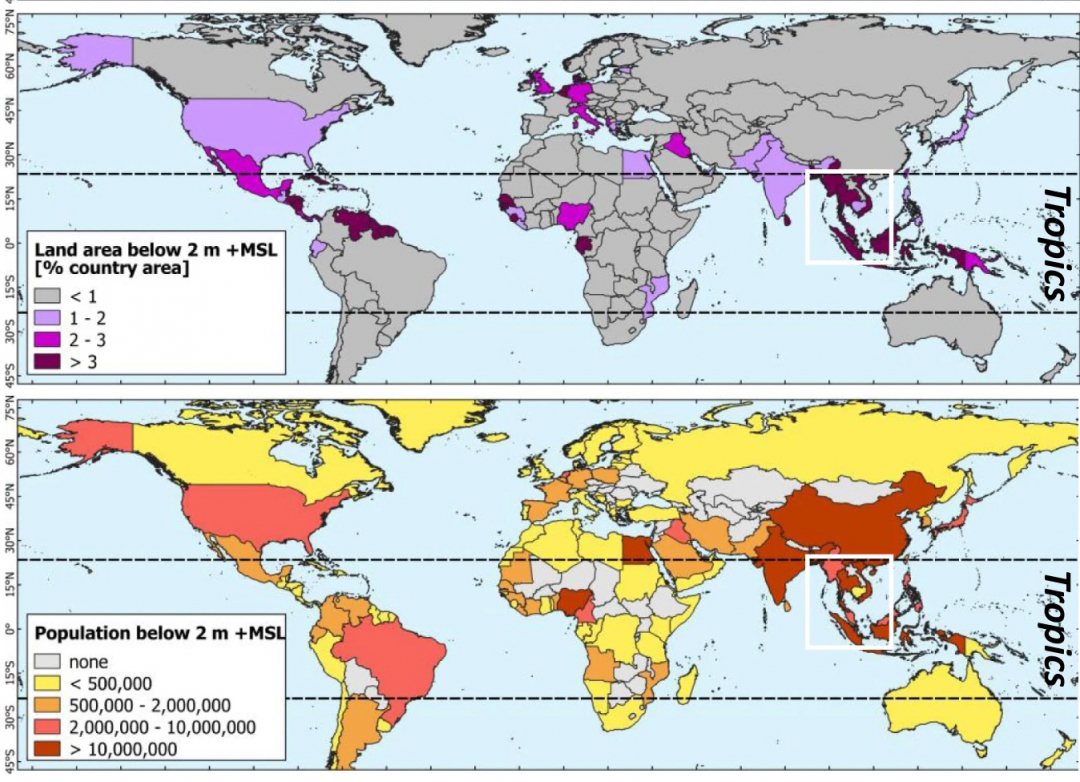
The research showed that of the worldwide land area less than 2 m above mean sea level, some 649,000 km2 or 62 percent is in the tropics. Even in the case of a low-end relative sea level rise of 1 m by 2100 and a stable lowland population number and distribution, the 2020 population of 267 million on such land would increase to at least 410 million of which 72 percent in the tropics and 59 percent in tropical Asia alone.
More accurate coastlines
‘To assess flood risks, we need to know the exact land elevation’, explains Aljosja Hooijer, a researcher at Deltares and the National University of Singapore, and first author of the paper. ‘In places like the Netherlands or Singapore, the land surface is mapped very well and we know the elevation relative to mean sea level for any location. However, the exact land elevation is not known for most regions around the world', Hooijer states,
Accurate data are particularly scarce in the tropics and it has now emerged that two-thirds of the world’s lowest coastlines are there.

Tropical regions in particular
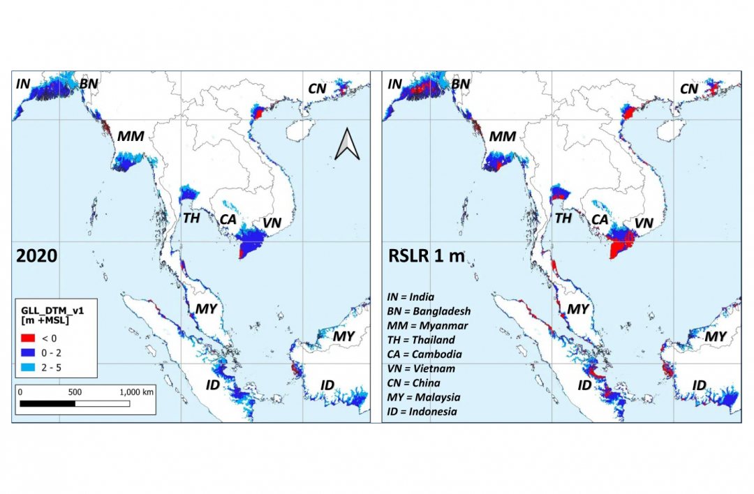
'Now that we have these accurate data', he continues, 'experts and policymakers will be better informed about the locations of the most vulnerable areas and they can focus on those areas. Three-quarters of the populations most at risk are in the tropics, especially Southeast Asia'.
As the problem is exacerbated there by land subsidence resulting from drainage and groundwater pumping, the researchers advise strengthening support for countries like Indonesia and Bangladesh to prepare for a sea level rise while reducing land subsidence.
Read the full paper Global LiDAR land elevation data reveal greatest sea-level rise vulnerability in the tropics on Nature Communications.

