Day-to-day calculation of water storage capacity in soil
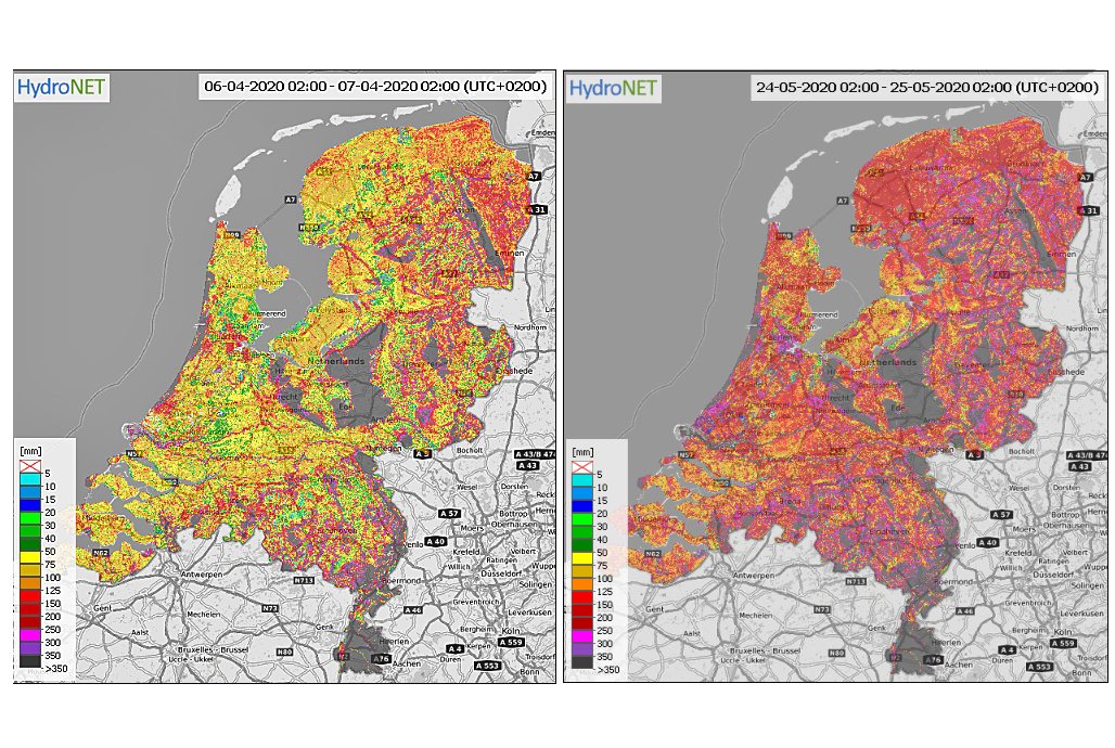
Since May, Dutch water managers have free access to the OWASIS nation-wide information system that provides a daily calculation on soil moisture, ground water levels and evaporation. Special about OWASIS is the accurate information on available capacity of the soil to store additional rain water.
The system supports water managers to make decisions on retaining and discharging surface water and ground water during dry and wet periods.


Daily update on soil water
OWASIS has been developed by a consortium that includes HydroLogic and E-Leaf as part of the Integrated Applications Promotions’ programme of the European Space Agency (ESA) and commissioned by Netherlands Space Agency (NSO).
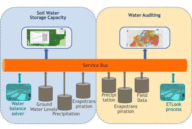
On a daily basis the system collects data from weather stations, ground(water) monitoring networks, local vegetation and satellite data to calculate the remaining capacity of the soil to capture water.
The combined data is then used to make nation-wide calculations on how much rain water can still be stored, or how much soil water is still available. For both cases, OWASIS provides information on the current and expected situation up to 2 days in advance. It also collects data from weather models to predict the water availability in a week from now.
Retain or discharge?
These calculations are important for water managers to decide whether or not to open dams or to adjust the capacity of drainage pumping stations to pump more or less surface water from low lying polder areas.
In periods of heavy rain fall it is important to know the remaining capacity of the soil to buffer rainwater as this preludes on the run off to surface waters and, consequently, the raise of water levels and possible flooding.
In periods of drought it is important for water managers to determine the necessity to close dams or decrease the drainage, in order to retain as much water as possible as a timely measure to prevent water shortages or a severe dropping in groundwater levels.
Anticipating cloud bursts
Pilots in the Netherlands during the dry summers of 2018 and 2019 proved OWASIS to be an important tool to manage surface water flows to bring back groundwater to its normal winter levels.
Hydrologist Joost Heijkers at Dutch regional water authority De Stichtse Rijnlanden participated in the pilots and emphasises the importance of OWASIS to be able to anticipate on extreme rain fall. ‘Even in dry periods, a cloud burst can cause flooding’, Heijkers explains.
‘For such occasions, it is not only important to have a dynamic information system that provides insight in drought, but also to have insight in the available storage capacity, including the soil. OWASIS provides us with an action perspective, even beyond the boundaries of our own catchment area.’


Additional version
The provision of information on water storage capacity is a new application of OWASIS. Earlier, HydroLogic and E-Leaf developed a version of OWASIS for water audits. This version uses evapotranspiration data from satellites, and rain fall data from rain gauges and radar to calculate water use linked to irrigation.
Such water audits allow water managers to compare the allocated amount of water and the real water use per farm. This information is displayed in graph and map format on various spatial scales. The OWASIS audit version has specially been developed for South Africa water authorities and is in use since 2018.


