Dutch knowledge institutes behind the first high-resolution time-dependent groundwater model of the world
Groundwater scientists and model developers from Utrecht University and Deltares create the very first one-kilometre (1 km) groundwater model with global coverage. This is an important step towards establishing a better representation of groundwater in global water and climate models.
More than 97% of the earth’s non-frozen freshwater is stored in underground aquifers. Groundwater plays an essential role in supporting the flow of rivers during periods of droughts and maintaining the health of wetland ecosystems. Groundwater is also the source of half of the water used for irrigation worldwide, especially in arid areas where groundwater extraction usually leads to falling groundwater levels and aquifer depletion.
High spatial resolution for global groundwater systems
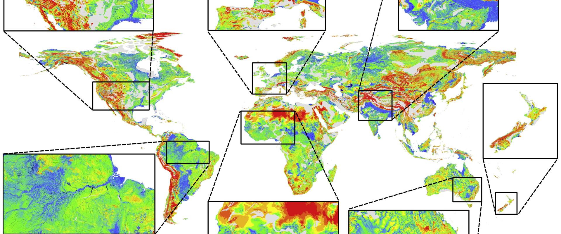
Groundwater is not very well represented in global water and climate models that are used to assess the effects of climate change and socio-economic changes on water stocks. Despite its importance, groundwater is usually not considered in these models, and when it is, this resource is treated simplistically. The first global groundwater models were created only recently. Yet, their coarse resolutions did not allow a proper representation of smaller aquifers and the exchange of water between groundwater and surface water. The newly developed model, referred to as GLOBGM, is an important step forward in this regard because it aims to represent global groundwater systems with a high spatial resolution of 30 arcsecond (~ 1 km).
A computer cluster is needed to be able to run such a very large model, but the cluster itself does not have to be very large. Jarno Verkaik, a PhD candidate at Utrecht University and a groundwater software expert at Deltares, was responsible for making this possible. “I modified the underlying model code (MODFLOW 6) so that it runs efficiently in parallel on multiple processors of a computer cluster. I applied unstructured grids to minimise the number of computational cells and associated runtime and storage. I also applied parallel data processing to handle the large number of terabytes of input and output data. With these modifications, we can now calculate 60 years in a single night with limited computer power. Moreover, users that do not have access to very large computers can also use this model,” explains Verkaik.
At the forefront of global groundwater modelling
The results of the global runs were compared with observations. The results were satisfactory, even without calibrating the model, and they were also found to be better than those from an earlier, coarser (~ 10 km), version of the model. "This development put us at the forefront of global groundwater modelling," says co-author Marc Bierkens, professor of hydrology at Utrecht University. "It combines the strength of Deltares in developing modelling tools with that of our group’s extensive modelling expertise and global datasets," Bierkens adds.
Relevance for regional water managers
“It will not stop here”, adds Gu Oude Essink, groundwater expert at Deltares and guest associate professor at Utrecht University. "We intend to add more geological detail, as much local data as possible, including groundwater extraction, and include saline groundwater in coastal aquifers. In this way, we are paving the way for future global water models that are good enough to be relevant for regional water managers.

