Explorer tool for water harvesting options in Western Sahel
Groundwater consultancy Acacia Water launched a web-based decision support tool for identifying small scale water harvesting options in the Western Sahel. The tool has been developed in cooperation with RAIN, MetaMeta, IHE Delft and WOCAT.

Landscape interventions
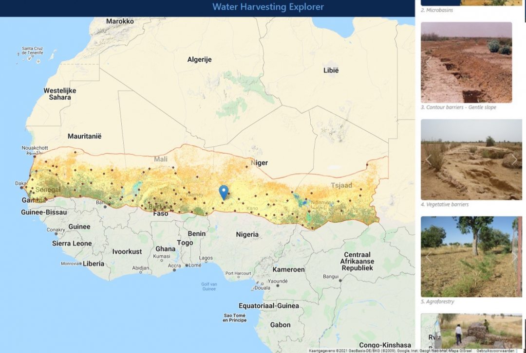
The online webtool provides an overview of the sustainable small-scale interventions that may be used in the Western Sahel landscapes. It allows practitioners to compare the possible harvesting technologies, based on biophysical typologies, like precipitation, topography and land cover.
The webtool further enables the user to plan the given interventions by conducting a rapid survey of the implementation modalities. Overall, it supports strategic decisions about water harvesting in the Western Sahel based on the available biophysical data.

Simple navigation
Navigating the Water Harvesting Explorer tool starts with clicking on the map at the location of interest. Given the circumstances at this selected location, the explorer shows the options to intervene in the landscape for the storage of more rainwater. The explorer links to the database of World Overview of Conservation Approaches and Technologies (WOCAT) that provides best practices for land and water resource management, such as digging pits, construction of dams, creation of an off stream water storage, planting vegetative barriers and agroforestry.
The partners of Acacia Water in the development of the tool are RAIN, MetaMeta, IHE Delft and WOCAT. Support was provided by the technical backstopping partners of Global Water Partnership, Verdant Earth, Stockholm Resilience Centre and Unesco-IGRAC.
