Scanning the subsurface: A new approach to mapping fresh and saline groundwater
Salinisation is an increasing threat to food security, biodiversity, and safe drinking water supplies worldwide. Rising sea levels, changing rainfall patterns, and growing freshwater demand accelerate the intrusion of saltwater into coastal and delta areas. Global consequences are profound: today, more than 1.4 billion hectares of land are salt affected. This number set to grow significantly as climate change and unsustainable land and water use intensify. These developments put pressure on agriculture, natural ecosystems, and the availability of drinking water resources.
Provinding a clearer picture of the Dutch subsurface
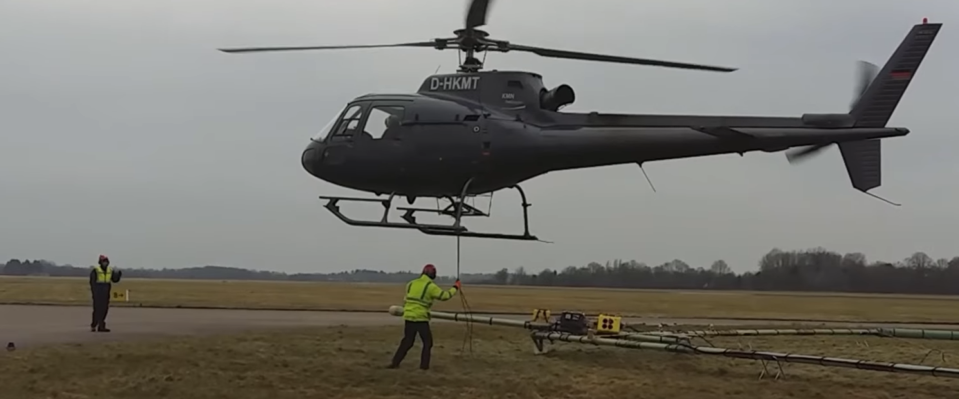
In response, a consortium of Dutch provinces, water authorities, drinking water companies, and knowledge institutes has launched FRESHEM-NL. This project applies an innovative method to provide a clearer picture of the Dutch subsurface. A helicopter carries electromagnetic equipment that scans the ground from above. This technique has long been used in mining worldwide but is now adapted to support sustainable groundwater management. The measurements will ultimately be transformed into detailed three-dimensional maps showing groundwater salinity and the continuity of protective clay layers in the Netherlands. Watch the news item: Deze megahelikopter speurt naar zoet en zout grondwater.

Scanning the subsurface from the air
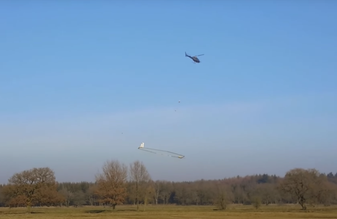
A key element of the project is the use of a helicopter equipped with a large circular frame that emits short electromagnetic pulses. These signals make it possible to measure the electrical resistance of the subsurface to depths of around 200 metres. Fresh water conducts electricity less well than saline water, and sand less well than clay does. These differences allow the measurements to reveal clear contrasts between the various layers. High resistance values generally point to freshwater or sandy soils – and low resistance values indicate clay or saline groundwater.
Collecting data on the ground
Fieldwork is carried out to support and validate the helicopter surveys. The composition and variability of the subsurface influence the airborne measurements. That is why soil samples are collected and analysed to improve the interpretation of the data. In addition, ground-based measurements help to fill gaps where flights are not possible or where data are disturbed.

Turning data into maps
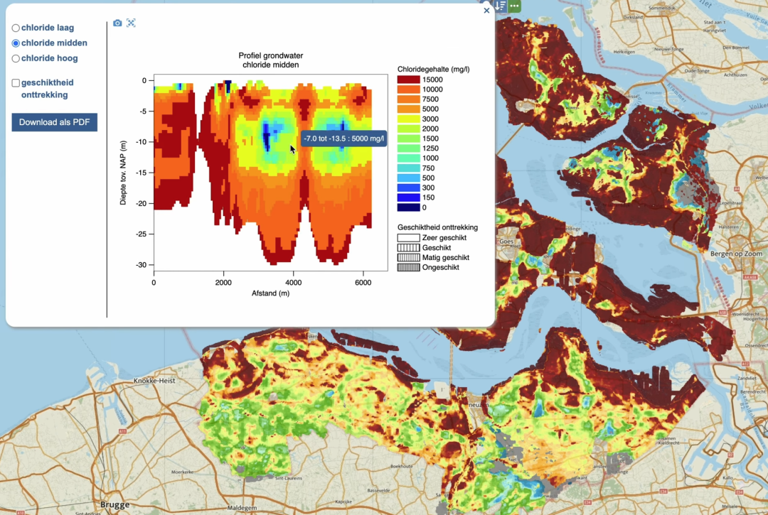
The results of the helicopter surveys and soil analysis are transformed into detailed three-dimensional maps of groundwater salinity and protective clay layers. To enhance accuracy, FRESHEM-NL combines these data with borehole records, geophysical surveys, and existing geological models. By applying advanced data science and machine learning, uncertainties are reduced and additional detail is revealed. This integrated method is capable of detecting patterns and predicting trends that conventional techniques might overlook.
A joint investment
FRESHEM-NL is the result of a broad collaboration between seven provinces, seven water authorities, five drinking water companies, and the knowledge institutes Deltares and TNO. Together, they aim to generate scientific data and maps that form the basis for future-proof freshwater management in the Netherlands. The project has a budget of €7 million, half of which is funded through the national Delta Programme on Freshwater and half contributed by the participating partners. This shared investment underlines the importance of collective responsibility in tackling salinisation.
Guiding groundwater use
Compared to conventional methods, FRESHEM-NL’s multimethod approach is faster, less intrusive, more cost-effective, and provides much broader coverage. The resulting three-dimensional maps show where fresh and saline groundwater occur and how protective clay layers are distributed. This knowledge is crucial for safeguarding drinking water, supporting agriculture, and protecting nature.
Practical implications
The benefits are tangible for a wide range of stakeholders. Farmers gain insight into where freshwater is available for irrigation and where saline intrusion may threaten crop yields. Drinking water companies can better identify aquifers that are well protected and suitable for long-term abstraction. It also supports exploration of brackish reserves as a potential future resource. For nature managers, the data highlight ecosystems most vulnerable to salinisation. These insights can support more informed and sustainable decisions on groundwater use and protection.
Beyond the Netherlands
By combining cutting-edge technology, scientific expertise, and broad collaboration, FRESHEM-NL provides a new foundation for groundwater management. Although designed for the Dutch Delta, the project’s methods and insights are highly relevant to other coastal and delta regions facing similar challenges. It offers a transferable approach to mapping groundwater systems under stress from salinisation and demonstrates how innovation can deliver practical tools to support agriculture, drinking water provision, and nature conservation. By sharing the results openly, the project contributes to global knowledge on how to protect freshwater resources in vulnerable environments.
Looking ahead
The first results from the measurements are expected at the end of 2025. Once processed, the data will be made accessible through the online platform of FRESHEM-NL. This will enable stakeholders across sectors to apply the findings in practice and integrate new insights into groundwater management.

